

Tropical depression likely to strengthen into storm, heavy rain expected

VOV.VN - A slow-moving tropical depression is approaching the Gulf of Tonkin and could strengthen into a storm on August 21, that will bring heavy rain to northern Vietnam.
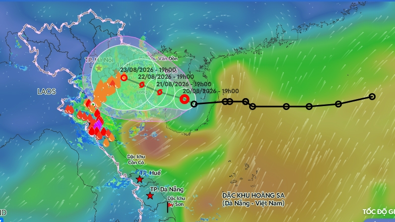
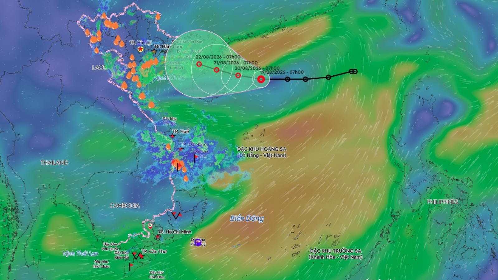
As of 7 p.m. on August 20, the centre of the system was northwest of China’s Hainan Island, with maximum sustained winds of 39-49 kmh and gusts of around 60-75 kmh. It was moving west-northwest at around 5 kmh.
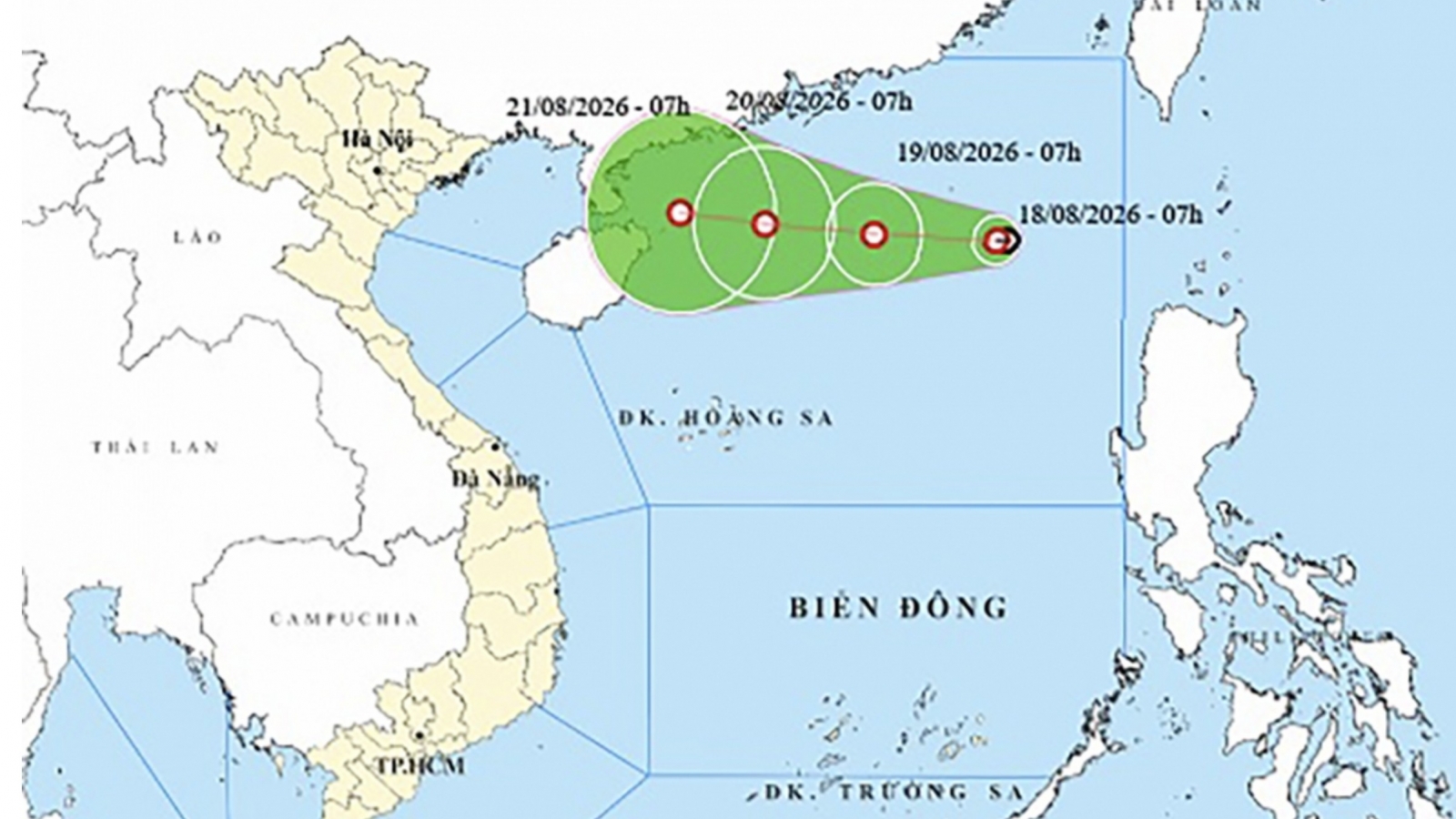
By the evening of August 21, the system is forecast to enter the Gulf of Tonkin and could strengthen into a storm, with winds of 62-74 kmh and gusts of up to 100 kmh. Its centre could then be about 200 km east-southeast of Hai Phong.
By the evening of August 22, the system is expected to continue moving slowly west-northwest at around 3-5 kmh, potentially approaching the northern coast of Vietnam.
The system’s slow movement is a key concern, while its interaction with the tropical convergence zone and surrounding weather patterns could still alter both its track and intensity.
Heavy rain returns to northeastern Vietnam
Forecasters have outlined two main scenarios for its impact on land. The first scenario, with a 60-70% probability, is currently considered more likely. Under this scenario, after entering the Gulf of Tonkin, the system would continue moving slowly, strengthen into a storm and then turn northward, potentially making landfall along the northeastern coast.
If this scenario unfolds, heavy rain could return to northern Vietnam from August 21, with the northeastern region likely to receive the heaviest rainfall.
Cao Bang, Thai Nguyen, Bac Ninh, Hung Yen, Hai Phong and Quang Ninh could experience heavy to torrential rain.
For areas that have already received prolonged rainfall, additional rain could increase the risk of flooding in low-lying and urban areas, while mountainous locations could face higher risks of flash floods and landslides.
Longer-lasting extreme rainfall
The second scenario, with a 30-40% probability, is considered the more extreme rainfall scenario. Under this track, after entering the Gulf of Tonkin and strengthening into a storm, the system would continue moving slowly westward and could make landfall in the southern part of the Red River Delta before weakening.
In this case, heavy to torrential rain could be concentrated in northeastern Vietnam, with the heaviest rainfall expected from August 22 to 25.
This scenario is particularly concerning because the rain could persist over ground that is already heavily saturated after previous downpours. The risk of flooding, flash floods and landslides could therefore increase, especially in mountainous areas, along rivers and streams and on steep terrain.
Track could still change over the next two days
The weather agency said the two scenarios could still be adjusted as the tropical depression moves deeper into the Gulf of Tonkin over the next one to two days.
At sea, winds could strengthen as the system approaches the gulf, reaching 62-74 kmh with gusts of up to 100 kmh near the storm’s centre, accompanied by higher waves and rough seas. Vessels in the affected area could face strong winds, thunderstorms, waterspouts and high waves.
For areas on land, the main concern is not simply whether the depression becomes a storm, but whether heavy rain returns and persists for several days.
Coastal areas, northeastern provinces, mountainous regions and locations that have already experienced prolonged heavy rain should closely monitor subsequent forecasts and prepare for flooding, flash floods and landslides.
The weather agency stressed that it is still too early to determine the system’s exact landfall location. Residents should therefore follow both its track and the rainfall forecast rather than focusing only on whether the depression develops into a storm.
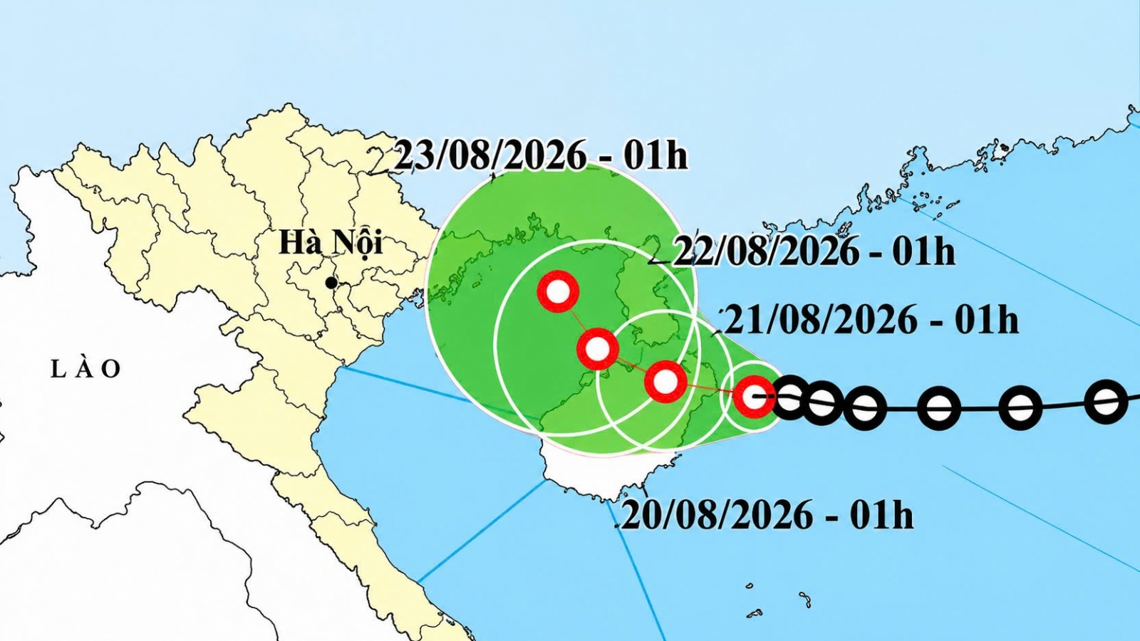
Tropical depression heads toward Gulf of Tonkin, may strengthen
VOV.VN - A tropical depression east of China’s Hainan Island is moving westward at 5-10 km/h and could gain force as it heads toward the eastern Gulf of Tonkin, according to the National Centre for Hydro-meteorological Forecasting.