


Tropical depression shifts course and intensifies over Gulf of Tonkin

VOV.VN - A tropical depression over the northern Gulf of Tonkin has intensified and changed direction toward the northwest, according to the National Center for Hydro-Meteorological Forecasting.
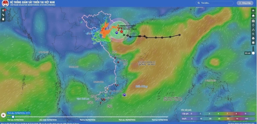
The system has already brought strong winds of level 7 (39-49 km/h), with gusts reaching level 9 (75-88 km/h), to Bach Long Vi Special Zone (Hai Phong), while Co To Island (Quang Ninh) recorded level 6 winds (39-49 km/h) with level 9 gusts.
As of 7:00 a.m. on August 21, the center of the depression was located at approximately 20.3 degrees North latitude and 108.5 degrees East longitude, roughly 100 kilometers east of Bach Long Vi. Maximum sustained winds near the center reached level 7 (39-49 km/h), with gusts up to level 9. The system was moving northwest at around 5 km/h.
By 7:00 a.m. on August 22, the system is projected to reach approximately 20.8 degrees North latitude and 108.5 degrees East longitude over the northern Gulf of Tonkin, about 190 kilometers east of Hai Phong and 120 kilometers northeast of Bach Long Vi.
Forecasts indicate the depression is likely to strengthen into a tropical storm, tracking north at 3-5 km/h with maximum sustained winds of Level 8 (62-74 km/h) and gusts reaching level 10 (89-102 km/h). The affected area encompasses the Gulf of Tonkin, including Bach Long Vi, Van Don, Co To, Cat Hai, and Hon Dau Island, carrying a level 3 natural disaster risk classification.
By 7:00 a.m. on August 23, the storm is expected to sit at roughly 20.8 degrees North latitude and 108.1 degrees East longitude over the northern waters of the Gulf of Tonkin, approximately 150 kilometers east of Hai Phong and 100 kilometers north of Bach Long Vi. Moving west at 3-5 km/h, the storm will maintain Level 8 maximum winds (62-74 km/h) and level 10 gusts (89-102 km/h), with the risk classification remaining at Level 3 for the region.
Over the subsequent 48 to 72 hours, the storm is predicted to alter its trajectory and move slowly southward at 3-5 km/h.
Under the influence of the weather system, the Gulf of Tonkin will experience strong winds of level 6-7 (39-61 km/h), increasing to level 8 (62-74 km/h) near the storm center with gusts up to level 10 (89-102 km/h). Rough seas are expected, with wave heights ranging from 2.5 to 3.5 meters. All vessels operating in these hazardous zones face severe risks from squalls, tornadoes, strong winds, and heavy waves.
Concurrently, satellite imagery, lightning location tracking, and weather radar data show convective cloud formations developing over several suburban districts and inner-city wards of Hanoi. The cloud mass continues to expand and intensify.
Forecasters warn that through approximately 11:00 a.m. on August 21, these convective clouds will bring rainshowers and thunderstorms to these areas before spreading to neighboring districts across Hanoi. During thunderstorms, residents should prepare for localized tornadoes, lightning strikes, and strong wind gusts.
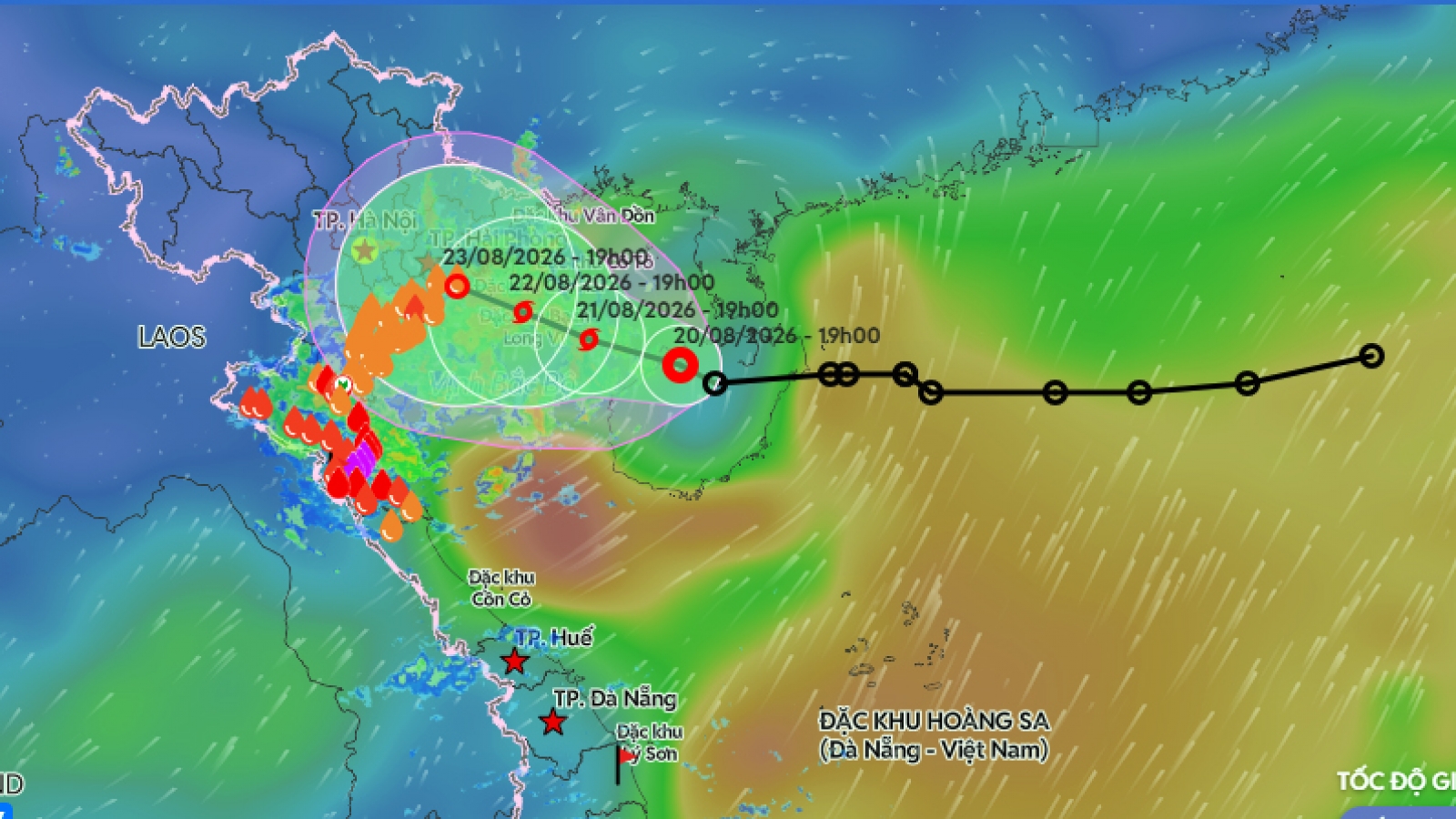
Tropical depression likely to strengthen into storm, heavy rain expected
VOV.VN - A slow-moving tropical depression is approaching the Gulf of Tonkin and could strengthen into a storm on August 21, that will bring heavy rain to northern Vietnam.
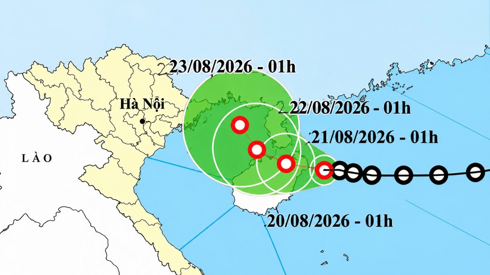
Tropical depression heads toward Gulf of Tonkin, may strengthen
VOV.VN - A tropical depression east of China’s Hainan Island is moving westward at 5-10 km/h and could gain force as it heads toward the eastern Gulf of Tonkin, according to the National Centre for Hydro-meteorological Forecasting.