


First storm of 2026 heads toward Quang Ninh, bringing heavy rain to northern Vietnam

VOV.VN - Storm No. 1, Vietnam’s first storm of 2026, is moving toward the Gulf of Tonkin and may directly affect Quang Ninh province in the coming days, bringing strong winds, rough seas, rising sea levels and heavy rain across northeastern Vietnam and Thanh Hoa province.
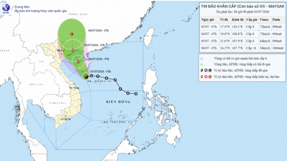
At 7 a.m. on July 3, the storm was located over waters northwest of the Hoang Sa special zone, with sustained winds of 62-74 kph and gusts of up to 102 kph, according to Vietnam’s National Center for Hydro-Meteorological Forecasting.
Over the next one to two days, it will turn north-northwest and move toward the Gulf of Tonkin before making landfall in coastal Quang Ninh on July 5.
The system is likely to maintain force 8 winds, with gusts up to force 10, as it moves inland.
By July 6, it is expected to weaken into a tropical depression before further weakening into a low-pressure system over southern Guangxi in China.
The storm is generating force 6-7 winds (39-61 kph) over the northwestern part of the East Sea, including the Hoang Sa special zone, with force 8 winds (62-74 kph) near its center and gusts of up to force 10 (89-102 kph). Its impact will extend into the Gulf of Tonkin from the night of July 3.
Waves may reach 2-4 meters, with rough seas posing risks to fishing boats, cargo vessels, tourist boats and other marine activities. Fishing, shipping and marine tourism may also face disruptions.
From the afternoon of July 4, coastal areas in Quang Ninh, Hai Phong and Hung Yen could see force 6 winds (39-49 kph), strengthening to force 7-8 (50-74 kph) near the storm’s center, with gusts of up to force 9-10 (75-102 kph).
Sea waves in coastal areas may reach 2-3 meters, while rising sea levels could reach 0.3-0.5 meters.
Strong winds may damage rooftops and temporary structures, uproot trees and disrupt power supply, telecommunications and transport. Large waves combined with rising sea levels could trigger localized flooding in river mouths, tidal flats and low-lying areas.
From the night of July 3 through July 5, northeastern Vietnam and Thanh Hoa are set for heavy to very heavy rain, with rainfall totals ranging from 100-200 mm.
Rainfall in northeastern areas may reach 150-250 mm, with some locations receiving more than 350 mm.
Persistent downpours may cause urban flooding in low-lying areas and industrial zones, while increasing the risk of flash floods and landslides in mountainous areas.
Residents in affected areas have been urged to closely monitor storm developments and follow official weather warnings and safety guidance.
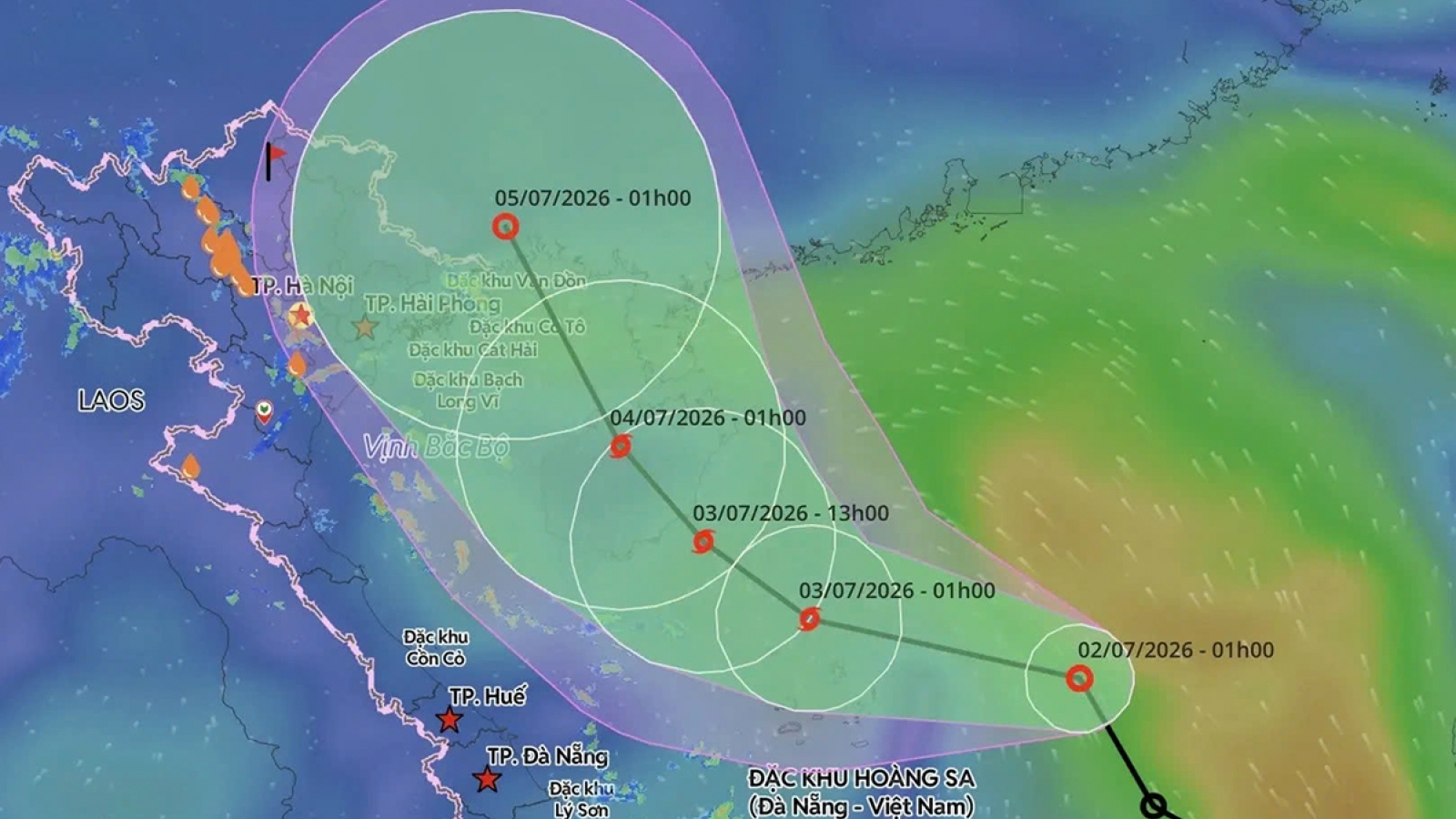
First East Sea storm of 2026 likely to form, Northern Vietnam on alert
VOV.VN - A tropical depression over the northern part of the East Sea is expected to strengthen into the first storm of Vietnam’s 2026 storm season later on July 2 or early July 3, with forecasters warning of rough seas and heavy rainfall across the northern region in the coming days.